


DIXON 11 Voting District, Lee County, Illinois
About
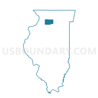
Outline

Summary
| Unique Area Identifier | 572602 |
| Name | DIXON 11 Voting District |
| County | Lee County |
| State | Illinois |
| Area (square miles) | 0.24 |
| Land Area (square miles) | 0.17 |
| Water Area (square miles) | 0.07 |
| % of Land Area | 69.28 |
| % of Water Area | 30.72 |
| Latitude of the Internal Point | 41.85276290 |
| Longtitude of the Internal Point | -89.47347810 |
Maps


Graphs
Select a template below for downloading or customizing gragh for DIXON 11 Voting District, Lee County, Illinois


Neighbors
Neighoring Voting District (by Name) Neighboring Voting District on the Map
- DIXON 1 Voting District, Lee County, IL
- DIXON 10 Voting District, Lee County, IL
- DIXON 12 Voting District, Lee County, IL
- DIXON 2 Voting District, Lee County, IL